Roswell Road Corridor
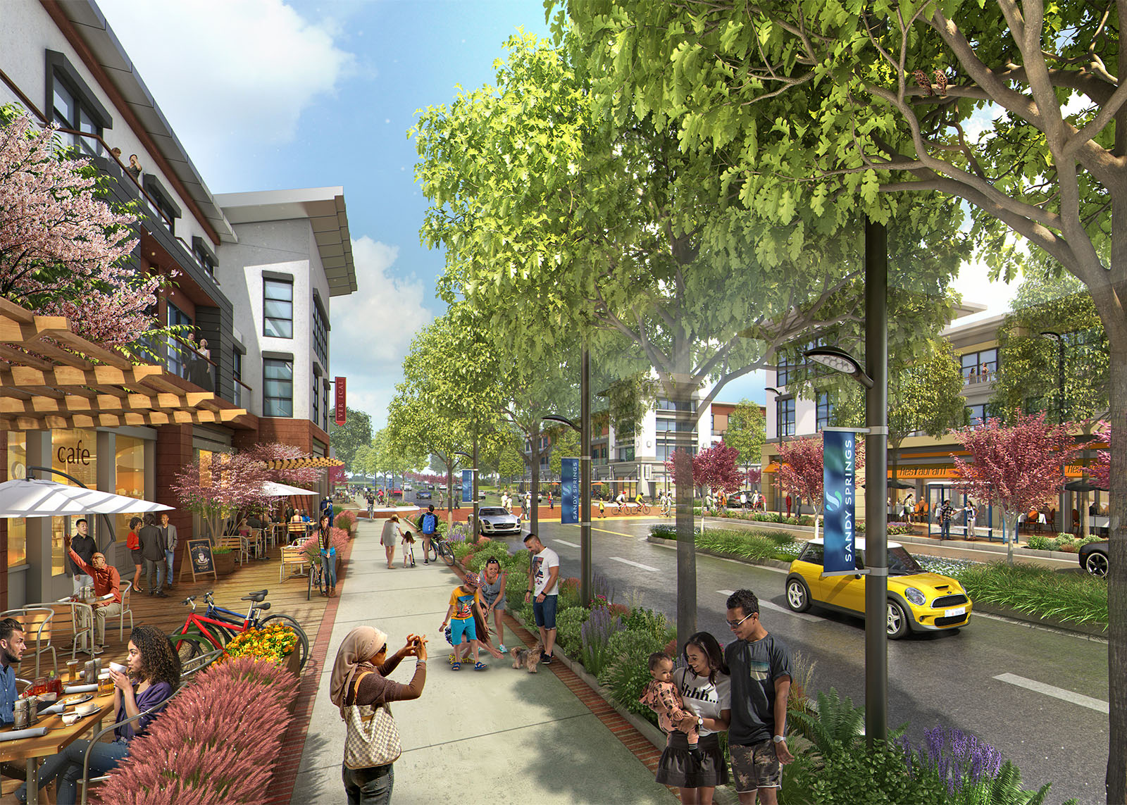
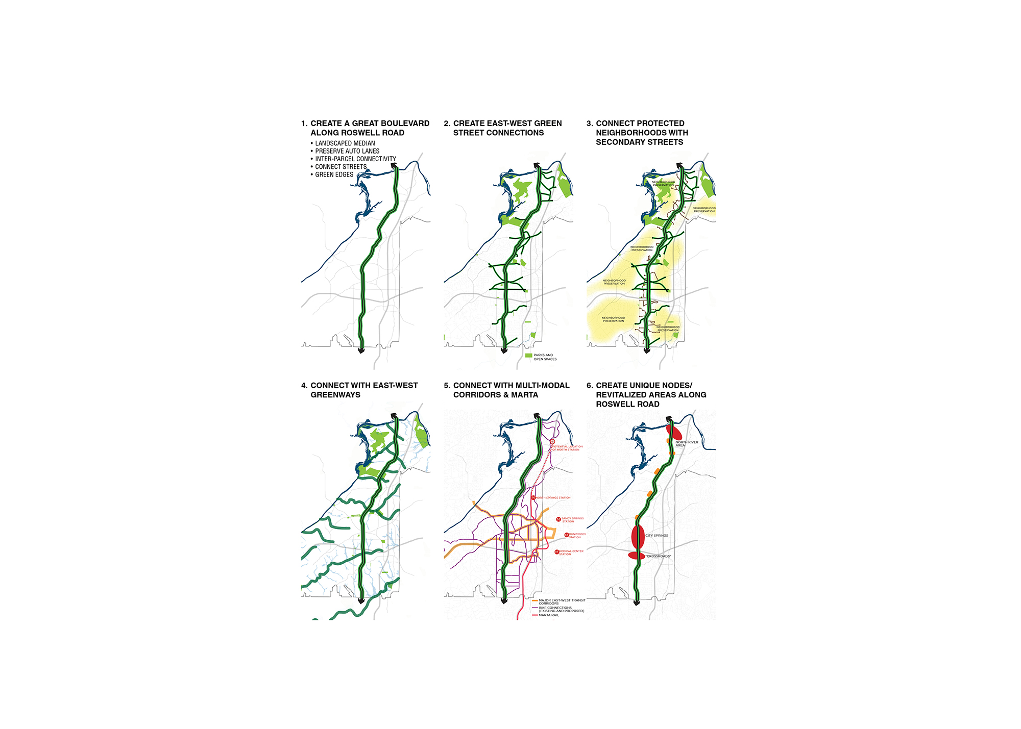
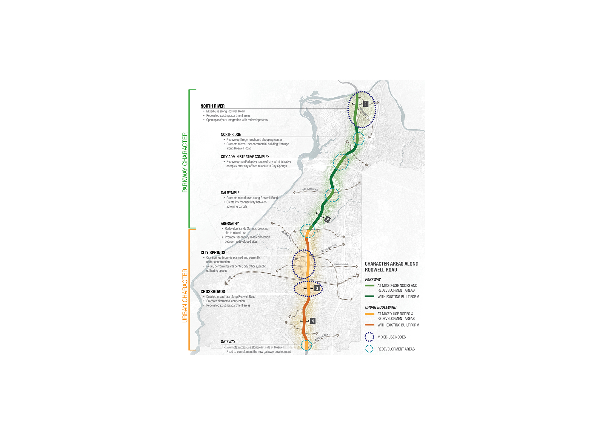
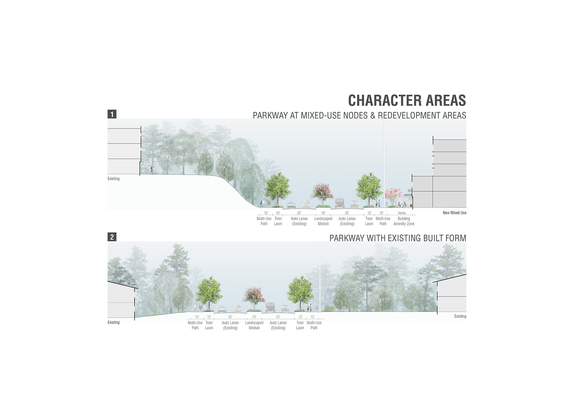
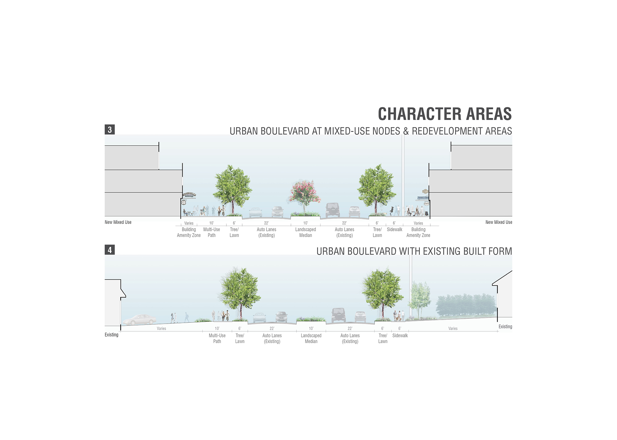
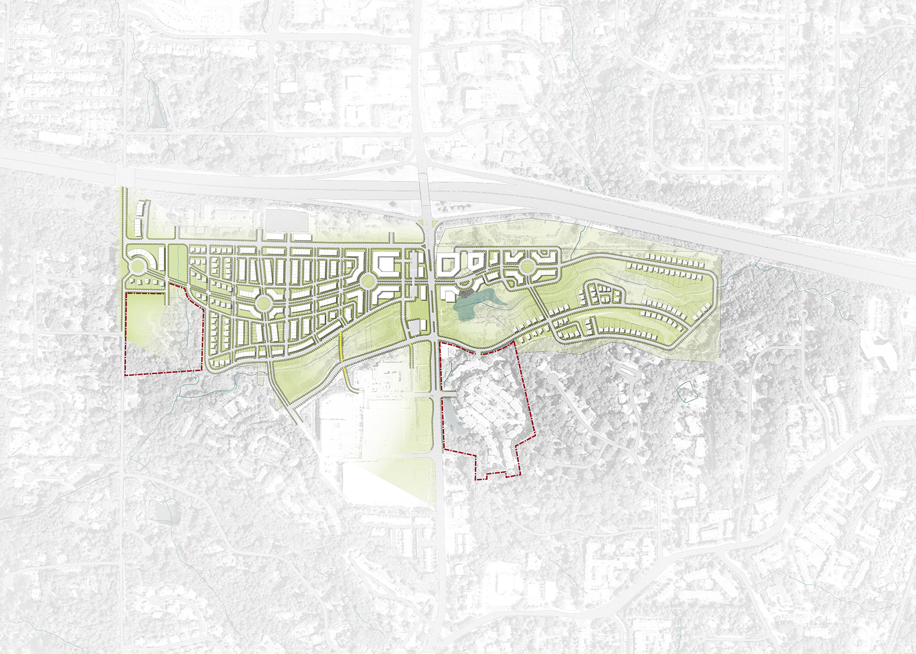
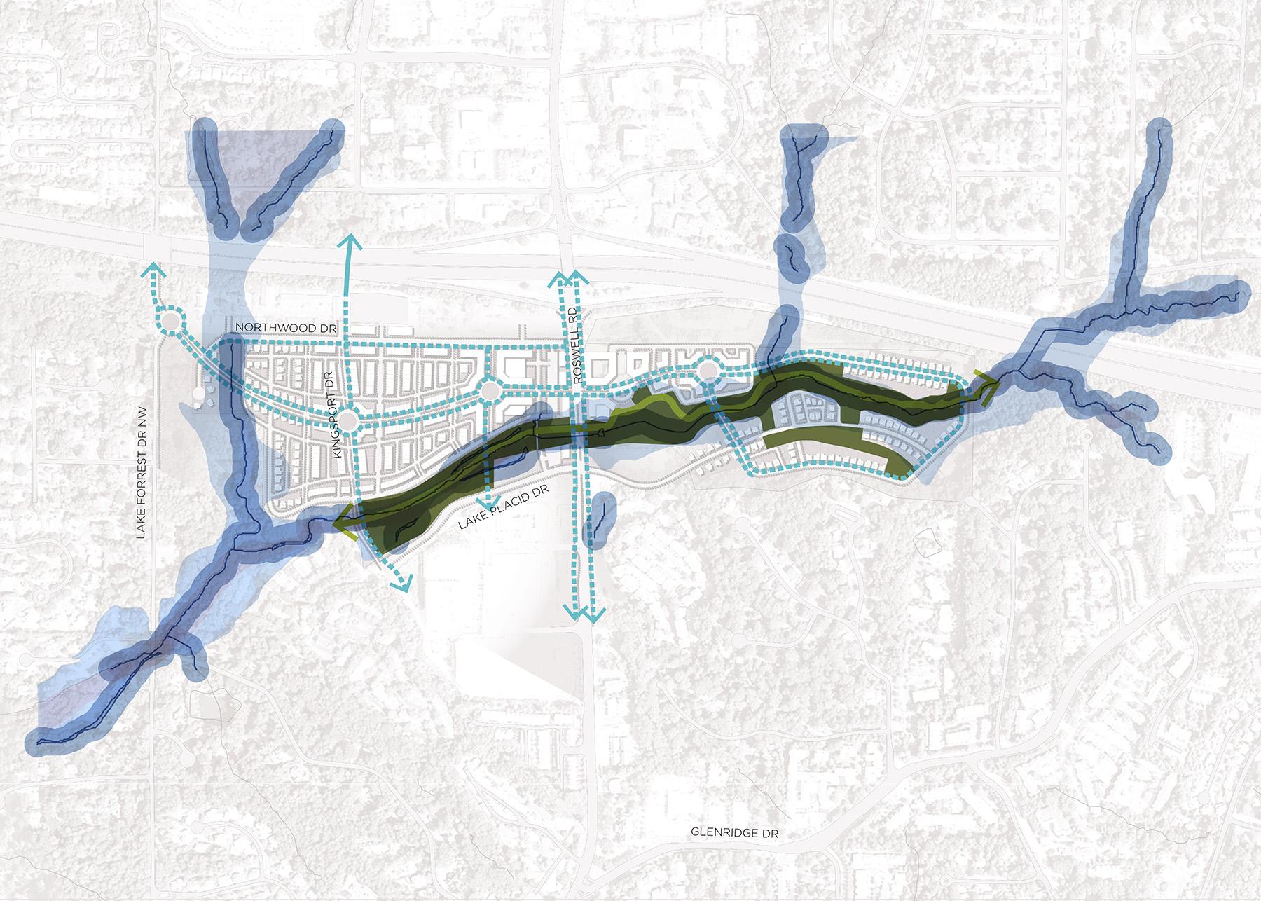
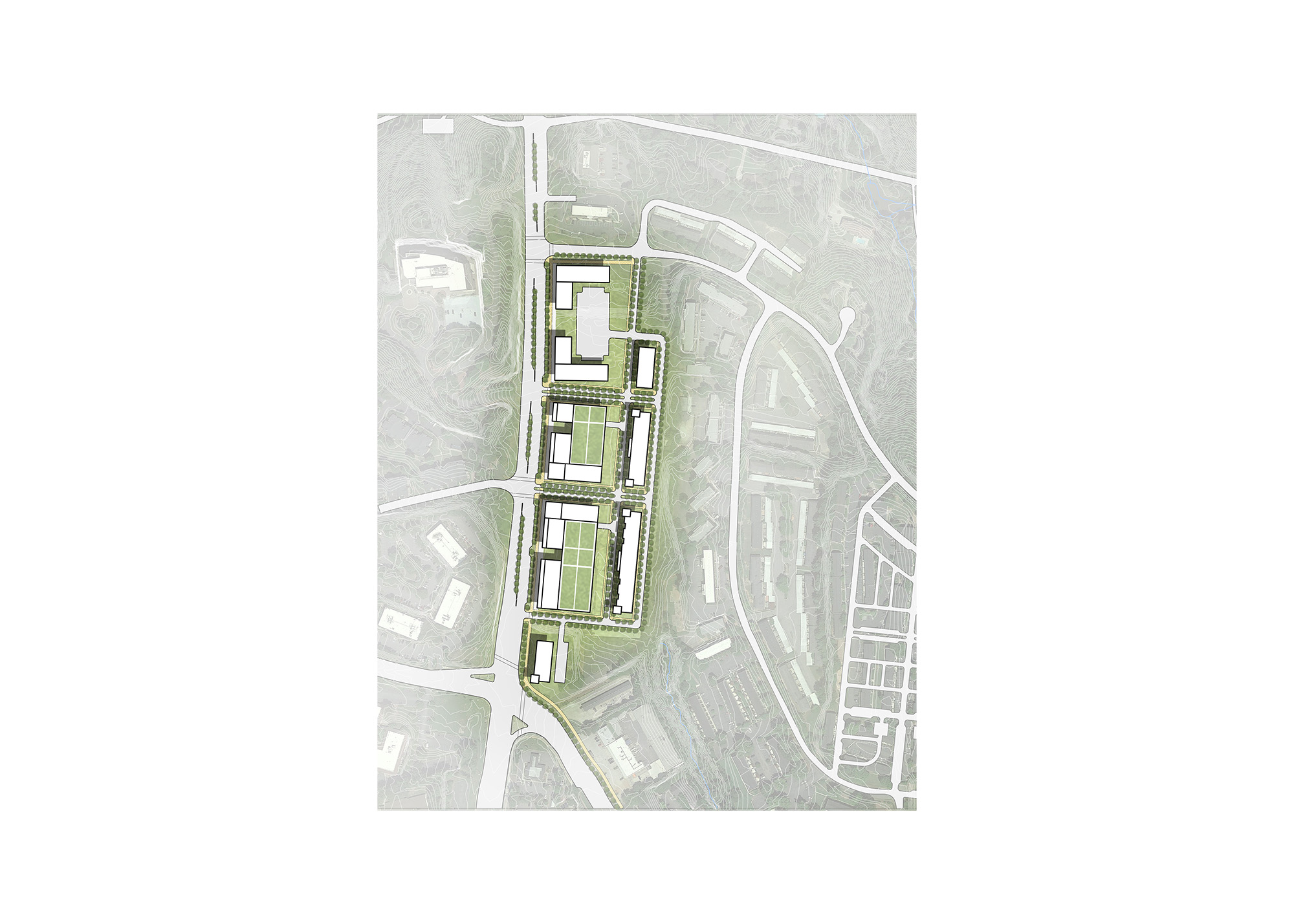
A nine-mile corridor through the City of Sandy Springs, Roswell Road functions as the city’s “main street,” connecting commercial areas to residential neighborhoods while providing a major transportation link between job centers and neighborhoods in the Atlanta metropolitan region. As the city urbanizes and seeks to become more walkable, Roswell Road remains a primarily suburban, auto-oriented corridor, defined by strip-commercial centers and surface parking lots. The Roswell Road Small Area Plan re-imagines the corridor as a great multimodal boulevard and strong north-south spine through the heart of the city. The plan reshapes the image of the corridor—and the city as a whole—by establishing a walkable, bicycle-friendly and transit-accessible environment with attractive streetscape amenities. Strategic redevelopment, incorporating a mix of land uses in compact development patterns, creates a dynamic, “live-work-play” corridor that links and protects neighborhoods, celebrates the area’s exceptional natural resources, and provides additional housing options, neighborhood amenities and job opportunities.